NORTH EAST 111
#970
NE 111 (115/115)
2019-08-13
| The Adirondack High Peaks, New York, USA 46/46 2014 #8434 |
| The White Mountains 4000 footers, New Hampshire, USA 48/48 2018 |
| Other 4000 footers for the NE 111, Catskills NY, Vermont, Maine, USA |
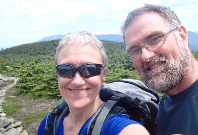
All hikes by Mary-Louise #970 & Gabriel #971
|
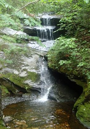
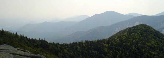
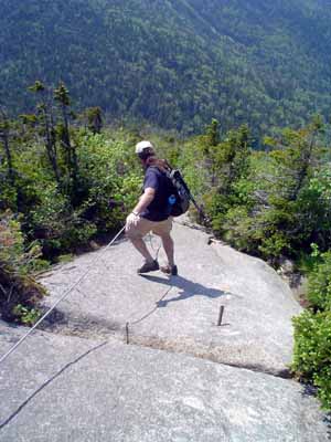
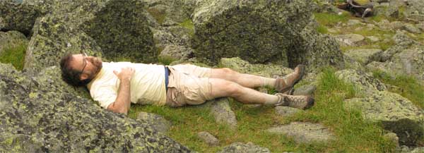
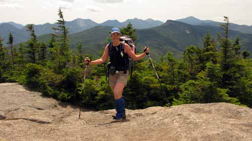
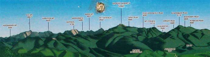
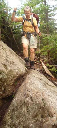
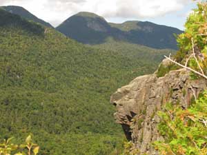
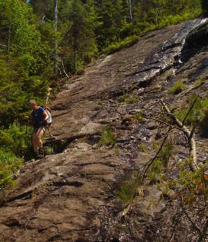
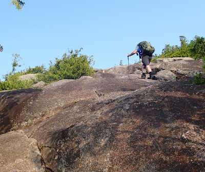
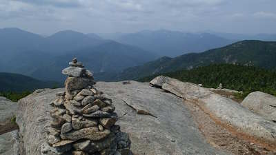
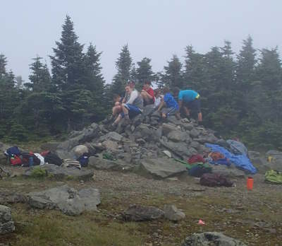
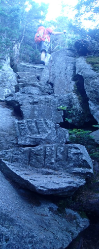
GOTHICS ~
SUNDAY, June 18th 2006
KNEES I
was careful all day.. used my poles up and down except for the part that had
cables.. and my knees gave me no problems at all.
wheather : Warm and sunny.. hot at the top
|
||||||||||||
|
SATURDAY,
August 12th 2006
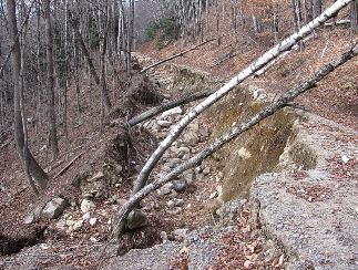
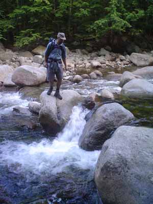
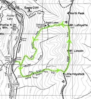
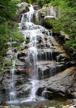
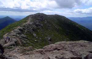
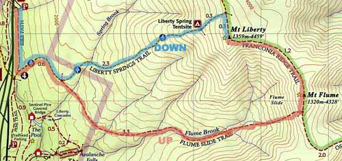
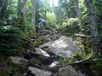
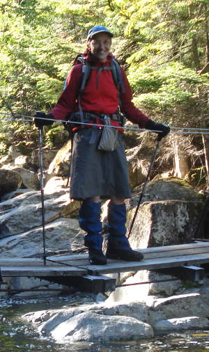
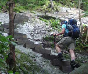
FRANCONIA NOTCH STATE PARK, New Hampshire, USA Rambling : hummmm 1,173 m, that's 3,848 ft.. talking about denivalation.. that's sort of like going up AND THEN down 7,696 six-inch steps..
|
|
SATURDAY, September
2nd
2006
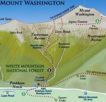
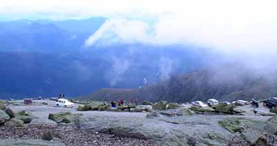
MOUNT WASHINGTON,
New Hampshire, USA
|
|
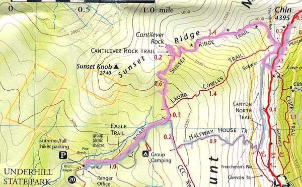
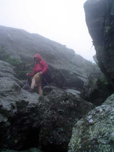
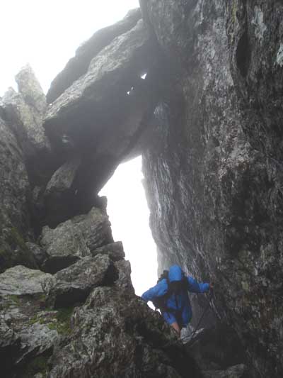
SUNDAY, August 26th 2007
MOUNT
MANSFIELD, Vermont, USA
my
order #1/21
// # 5 / 111
HIKING start 9h09 AM
LUNCH
Just a little
before the Short-cut up to
Long Trail
Last Short-Cut to Long Trail to
CHIN
DOWN
: Long Trail, Short-cut, Subway ,
( Counter clock-wise
loop )
Long Trail to
Sunset Ridge Trail to Cantilever Rock, and short lunch
NOTES :
|
|
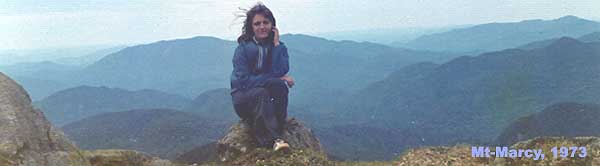
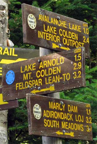
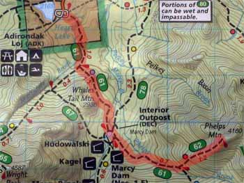
MARCY
~
SATURDAY,
September 1st 2007
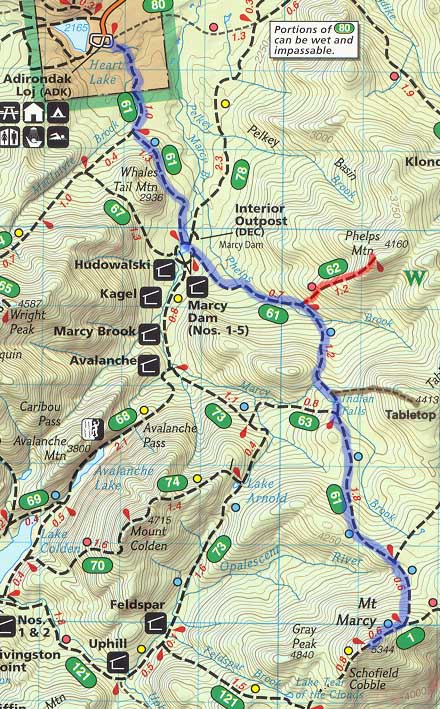
UP Starting at Adirondak Loj to about 0,6 mi from the top
BED AT 00h30 AM |
|||||||||||||
|
SUNDAY, September 16th 2007
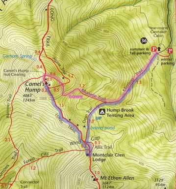
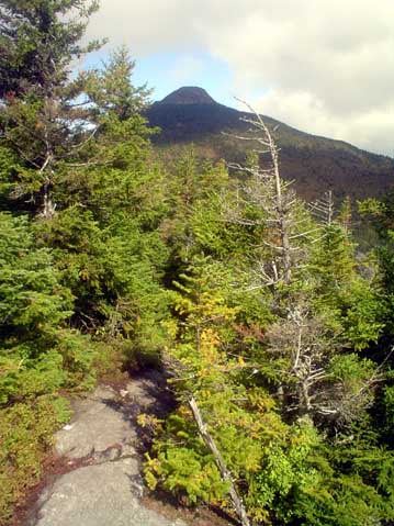
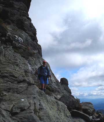
CAMEL'S HUMP, Vermont, USA
my
order #2/21
// # 7 / 111
UP
Monroe Trail to intersection, Dean Trail to Wind
Gap, Long Trail to Montclair Glen Lodge, back on
Long Trail to Wind Gap.
Wind Gap to
snack at about the 1000 m contour line ant then to
the top
DOWN
: Long Trail, Monroe Trail
NOTES :
BED AT 10h30 PM |
|
SUNDAY, September 23rd 2007
MOUNT JEFFERSON,
New Hampshire, USA
NOTES :
|
|||||||
Alpes & Pyrénées, France — Summer 2008
Alberta & BC, Canada
— Summer 2009
|
SUNDAY, August 16th 2009
FRANCONIA NOTCH STATE PARK,
New Hampshire, USA
HIKING start 8h02 AM
BED AT 11h00 PM |
|
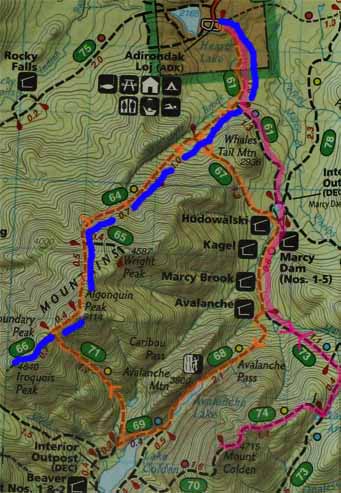
ALGONQUIN PEAK
~ THURSDAY,
July 29th 2010
BED AT 9h00 PM Whispering Pine
Campground, 4582 Cascade Road
(Route 73)
Lake Placid 518-523-9322 |
|
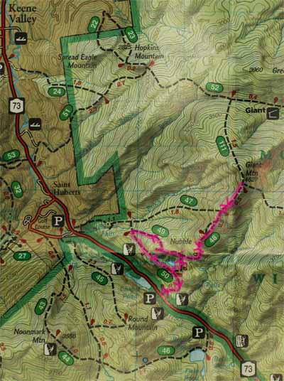
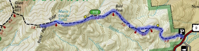
GIANT
~ FRIDAY,
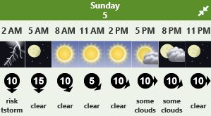
July 30th 2010 Forecast for Keene as of
Wednesday July 28th :
BED AT 9h00 PM
Whispering Pine Campground, 4582 Cascade Road (Route
73) Lake Placid 518-523-9322 |
|
COLDEN
~ SATURDAY,
July 31st 2010 Forecast for Keene as of
Wednesday July 28th :
Just across the lake from
Algonquin Peak
BED AT 9h00 PM
Whispering Pine Campground, 4582 Cascade Road (Route
73) Lake Placid 518-523-9322
|
|
BIG SLIDE
~ SUNDAY,
August 1st 2010
via The Brothers
CAR TRIP HOME 4-7 pm |
|
FRIDAY,
July 1st 2011
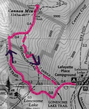
CANON MOUNTAIN, New Hampshire, USA
|
|
MOUNT ADAMS,
New Hampshire, USA
Campfire with Yves Richard and Cindy's friends' camp
sites #1&2. Yves and his friend did Mount Washington up
Amooos... and down Jewell |
||||||||
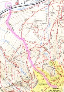
|
DIX
~ WEDNESDAY, July
27th 2011
UP
4h59 mins
BED AT 9h00 Camping day 2 Lincoln Pond Campground #20 / 4363 Lincoln Pond Road Elisabethtown, NY 12932 (518) 942-5892 |
|
CASCADE & PORTER
~ THURSDAY, July
28th 2011
UP
1h57 mins BED AT 9h00 PM at TMax-n-Topo's Jackrabitt Hostel 5046 Cascade Road (Route 73) Lake Placid 518-523-0123 http://tmax-n-topo.com/ "Dixes" |
||||
|
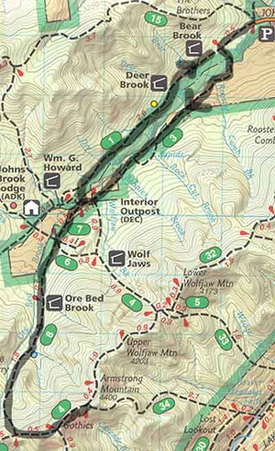
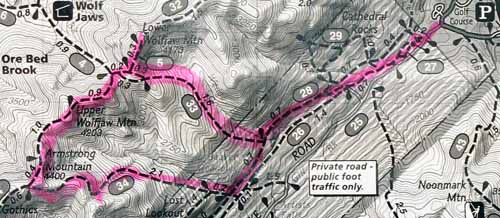
LOWER WOLFJAW, UPPER WOLFJAW & ARMSTRONG
UP TO LWJ TRAIL :
Wedge Brook Trail BED AT 9h30 PM at TMax-n-Topo's Jackrabitt Hostel 5046 Cascade Road (Route 73) Lake Placid 518-523-0123 http://tmax-n-topo.com/ "Dixes" |
||||
|
WRIGHT
~
SATURDAY, July
30th 2011
UP
2h40 mins
BED AT 9h30 PM at TMax-n-Topo's Jackrabitt Hostel 5046 Cascade Road (Route 73) Lake Placid 518-523-0123 http://tmax-n-topo.com/ "Dixes" |
|
PHELPS
~
SUNDAY, July
31st 2011
UP
2h37 mins BED AT 9h30 PM Camping day 1 KOA Lake Placid / Whiteface KOA 77 FoxFarmRoad / Wilminton NY 12997 (800) 562-0368 |
||||
|
|
|
WHITEFACE
Wilmington trail
&
ESTHER
Unmarked
TUESDAY, August
2nd 2011
UP TO WHITEFACE BED AT 9h00 PM Camping day 3 KOA Lake Placid / Whiteface KOA 77 FoxFarmRoad / Wilminton NY 12997 (800) 562-0368 |
||||
|
IROQUOIS
~ SATURDAY, August
20th 2011
BED AT 9h00
Camping day 2
Whispering Pine Campground, 4582 Cascade Road (Route 73) Lake Placid
518-523-9322 |
|
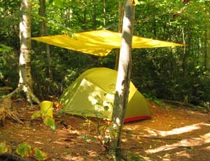
BACKPACK
IN
~
SATURDAY, September
3rd 2011
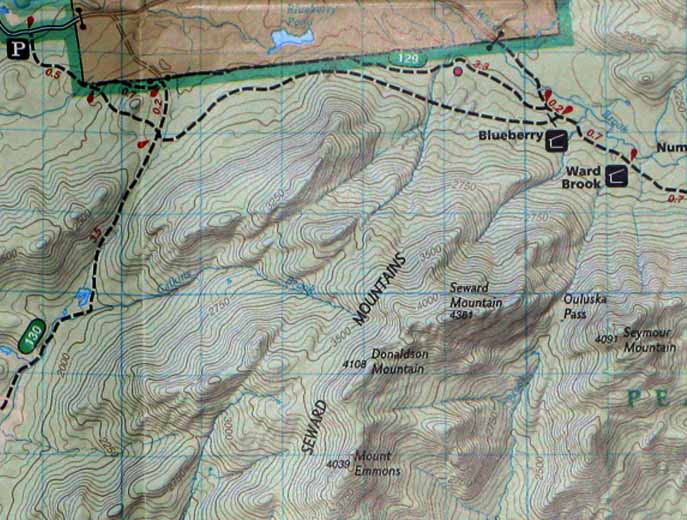
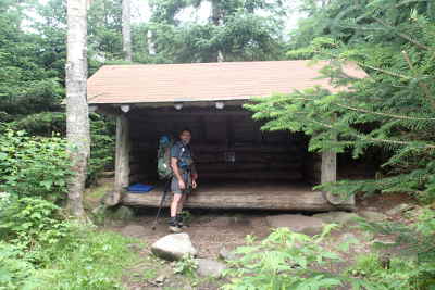
From P to Ward Brook Leanto
Put up tent near Lean-to and have Lunch
SEYMOUR
~
SATURDAY, September
3rd 2011
BED AT 8h30 PM Wilderness camping beside Ward Brook Leanto |
|
SEWARD,
DONALDSON & EMMONS
BED AT 9h30 PM Wilderness camping beside Ward Brook Leanto |
|
BACKPACKING OUT
~
MONDAY, September 5th
2011
time : 2h45 here is a copy of my post on adkhighpeaks.com/forums
CAR TRIP HOME BED AT 1h30 PM |
|
TABLETOP
~
SATURDAY, June
16th 2012
UP
3h27 mins
I really weigh 10 lbs toooooo much and am not in top shape like last summer. No view at the top but nice hike |
||
|
|
|
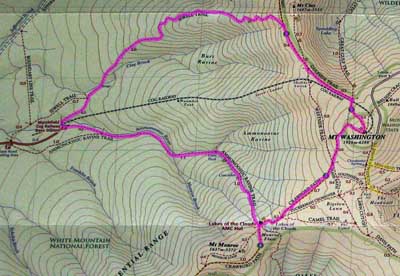
SATURDAY, June
30th 2012
UP
Ammonoosuc to Monroe, down to Lakes of the Clouds and
up Washington :
BED
AT 7h00 PM
! |
||||||
|
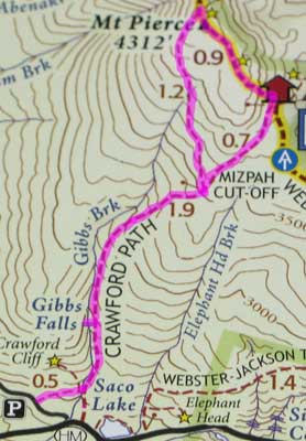
SUNDAY, July 1st 2012
Pierce (Clinton)
UP
2h42 mins / AveHR 120
72%
/ MaxHR 143
86%
/ 1048 cals / 45 % fat / 1h07 mins InZone
CAR TRIP HOME BED AT 11h00 PM |
|
BACKPACK
IN
~
MONDAY, July
23rd 2012
CAR TRIP to Adirondack Park, NY
(2nd trip)
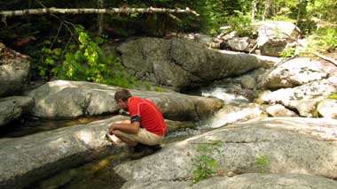
From P to FETCH WATER :, across from second campsite. 350m down hill and back up.
BED AT 6h30 PM !! LOL
Camping |
|
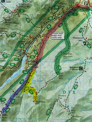
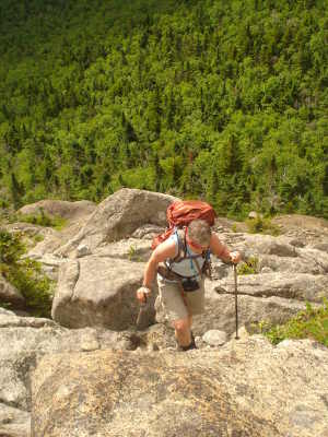
COLVIN
and BLAKE PEAK
~
TUESDAY, July
24th 2012
UP
FETCH WATER : with Gabriel, across from second campsite. 350m down hill and back up. BED AT xxh00 |
|
NIPPLETOP
~
WEDNESDAY, July
25th 2012
UP
FETCH WATER : with Gabriel, across from second campsite. 350m down hill and back up. BED AT xx PM |
|
BACKPACK OUT
~
THURSDAY, July
26th 2012
CAR TRIP HOME BED AT xx PM |
|
BACKPACK
IN
~
SATURDAY, July
28th 2012
CAR TRIP to Adirondack Park, NY
ORANGE TRAIL
From P to Bradly Pond Santanoni Leanto (camping)
BED AT ?? PM !! LOL
Camping |
||||
|
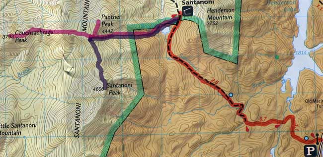
COUCHSACHRAGA & PANTHER
~
SUNDAY, July
29th 2012
BED AT xxh00 |
||||||
|
SANTANONI
PEAK
~
MONDAY, July
30th 2012
UP
BED AT xx PM in Bradly Pond Santanoni Leanto (first time in a Leanto) |
||||||||
|
BACKPACK OUT
~
TUESDAY, July
31st 2012
CAR TRIP HOME BED AT xx PM |
||||
|
DIAL
~
FRIDAY, August
3rd 2012
BED AT xxh00 at T-Max-n-Topo's Hostel |
|
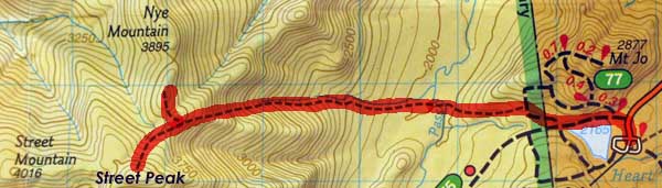
STREET
& NYE
~
SATURDAY, August
4th 2012
UP
to STREET lookout BUYING : "46 to ONE, A Journal" Maybe I'll write that journal in french .. for my son and grandaughters.. CAR TRIP HOME |
||||||
|
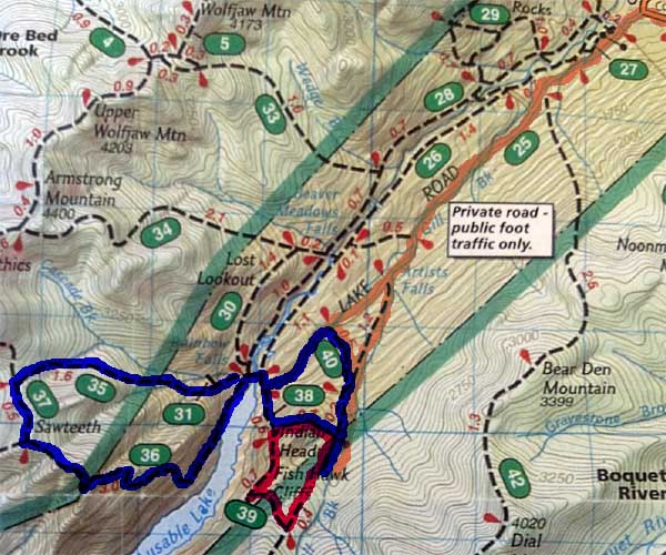
BACKPACK IN
~
SATURDAY, September
1st 2012
CAR TRIP to Adirondack Park, NY
ORANGE TRAIL via 40
From P to (2nd camping on Gill Brook Trail) via Gill Cut off
(40)
FISH HAWK CLIFF AND INDIAN HEAD LOOP
RED TRAIL BED AT ?? PM !! LOL Camping |
||||
|
SAWTEETH
~
SUNDAY, September
2nd 2012
BED AT xxh00 |
||||||||||||
|
BACKPACK OUT
~
MONDAY, September
3rd 2012
Breakfast with Mosa & Johnny
from Vermont at the "dinner" (river) . Johnny was a ranger in Montana and
seems to have alot of expercience hiking./ Gabriel and I talk alot about
coming back to do the east and west river trails (26 & 28) when we'll have
finished the 46 high peaks .. and re do the Gill Brook trail and the
Rainbow Falls as well when the water is high. With the Indian Head loop, it
can be a nice day.
Stove fuel : 3,5 oz per person / per day.. ?? CAR TRIP HOME |
||||
|
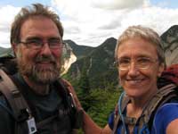
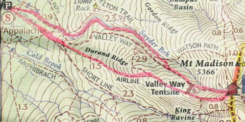
MOUNT MADISON,
New Hampshire, USA
HIKING
start 6 h 30 AM
|
|
BACKPACK
IN
~
MONDAY, July
15th 2013
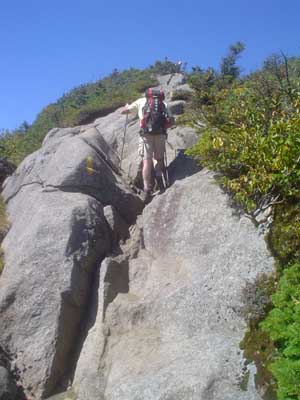
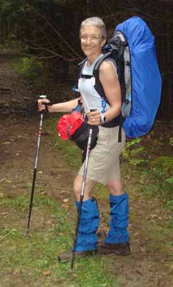
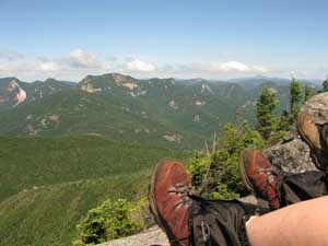
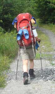
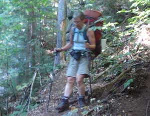
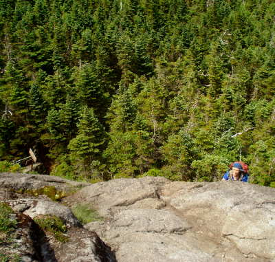
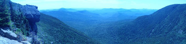
From Garden Parking to Bushnell Leanto # 1 WEIGHT OF PALISADE PACSAC : 39 lbs ALTITUDE : ASSENT ~ TOTAL LENGTH Since we're so early at the Leanto, Gabriel suggests we do the Haystacks today. Excellent call!
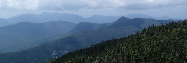
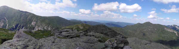
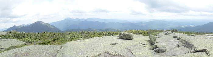
HAYSTACK
~
(banner pic, view from the top)
We meet Aspiring HP Queen and Fiddlehead (from
ADKHighPeakForums) at the Summit.
BED AT 8h00 at Bushnell Leanto #1 but only fall asleep around 10h30 (my usual time) |
|
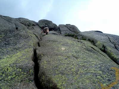
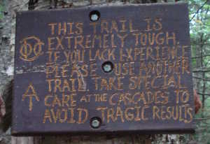
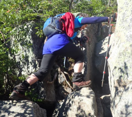
BASIN and SADDLEBACK
~ TUESDAY, July
16th 2013
Go
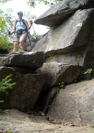
up the shortcut to Basin, the Saddleback "Wall" worried me
but was just fine. I guess we do have quite a bit of
experience, Gabriel and I, scrambling and stuff. Maybe we're
ready for Mount Washington's Huntington Ravine.
|
|
BACKPACK OUT
~ WEDNESDAY, July
17th 2013
as we came up on July 15th Bushnell Leanto #1 to
Garden parking
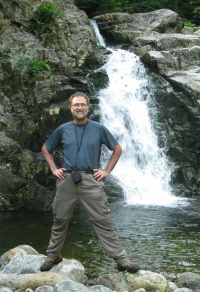
BUSHNELL FALLS
CAR TRIP HOME |
|
BACKPACK
IN
~
MONDAY, July
22nd 2013
From ADK Lodge to Feldspar Leanto
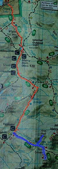
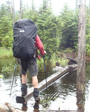
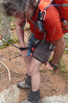
ORANGE on the map WEIGHT OF PALISADE PACSAC : 42 lbs ALTITUDE : ASSENT ~ TOTAL LENGTH See picture of floating bridge on July 23 rd.. ACHES & PAINS : my pack is Too heavy and my hip strap is mal ajusted, I actually develop 2 kysts! one on each side of my lower back, My right side is worse..
SKYLIGHT & GRAY
~
BLUE on
the map We m
BED AT 8h00 at b |
||||||||||
|
BACKPACK OUT
~
TUESDAY, July
23rd 2013 NOTE TO SELF : Bear Kegs are NOT rainproof! ACHES & PAINS : Gaby took the tent poles in his pack and I carry less water, but my kysts really hurt until about an hour and a half before the end of the trail ( Avalanche Pass) when I finally take the time to re-adjust my hip belt, but only manage to make it better, not perfect. At the end of the hike I manage to put it à the settings 4-4 that I would have needed all the time..
CAR TRIP HOME BED AT 10h30 PM |
||||
|
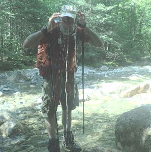
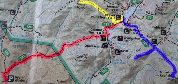
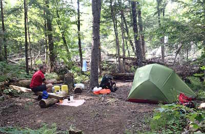
BACKPACK
IN
~
SUNDAY, August
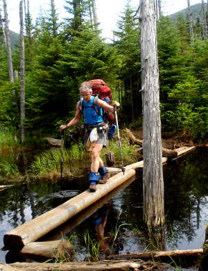
4th 2013 Day 1 From UPPER WORKS to Beaver Point Leanto, on Lake Colden RED LINE START AT am BACKPACKING time : ~ WEIGHT OF PALISADE PACSAC : 38 lbs / Water: 1,5 liters ALTITUDE : ASSENT ~ TOTAL LENGTH
BED AT 9h30 PM |
|
CLIFF &
REDFIELD
~ MONDAY, August
5th 2013 Go
|
|
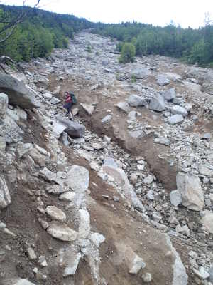
MARSHALL
~ TUESDAY, August
6th 2013
40/46
YELLOW LINE
As I posted on the adkhighpeaks
forum : There is a place where we missed a brook
crossing, and the herd path on the left side was very clear..
until at a big boulder, where it completely disappeard, as
we were coming down to find another route we met an
Assistant Ranger who had also taken the same path as us. We
went up to the boulder again and she confirmed that there
was no more trail there so we came down again.. we heard
voices on the other side of the brook, talked to the guys
comming down from Marshall, so we crossed the brook to the
right (and "right" ) side and the rest was easy.
|
|
BACKPACK OUT
~
WEDNESDAY, August
7th 2013
as we came RED LINE
NOTE TO SELF : Sometimes we are not lost, sometimes we are exactly where we're supposed to be.
ACHES & PAINS : Larengitis and sinusite CAR TRIP HOME BED AT 10h30 PM |
|||||
|
SATURDAY,
July 12th 2014
BED AT 9h30 PM at Country Squire Motel, Littleton. Room #3 |
||||||
|
BACKPACK
IN
~
WEDNESDAY, July
16th 2014
CAR TRIP to Adirondack Park, NY
START AT From Elk Lake parking to Camping near Slide Brook Leanto ORANGE on the map
BED AT 9h00 PM LOTS of noise.. until about
midnight coming from Leanto |
|
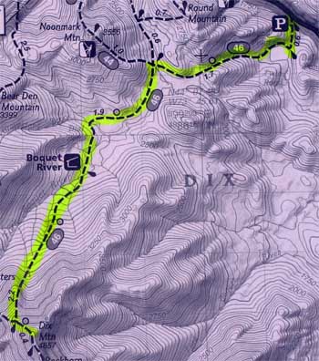
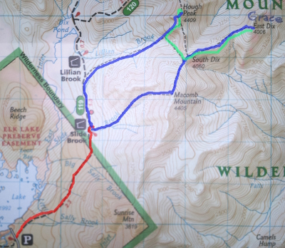
MACOMB, SOUTH DIX, GRACE, HOUGH
~ THURSDAY, July
17th 2014
From Slide Brook Campground to MACOMB to SOUTH DIX, GRACE (formerly
EAST DIX) , (back to South Dix) and then over to HOUGH, down Lilian
Brook
and back to campground near Slide Brook WEIGHT OF PALISADE PACSAC : ~20 lbs 4 liters of water, have 1,5 left over but it wasn't a hot/sunny day. ALTITUDE : ASSENT ~ TOTAL LENGTH
I think my motto for the day was "I've seen worse.." so all was good.
BED AT 9h00 at Slide Brook campground |
||||||||||
|
BACKPACK OUT
~
FRIDAY, July
18th 2014
CAR TRIP HOME |
|
BACKPACK
IN
~
MONDAY, July
21st 2014
CAR TRIP to Adirondack Park, NY
SUNDAY, August 4th
2013
CAR TRIP to Upper
Works near Newcomb in the Adirondack Park, NY
START AT
From
BED AT 9h30 PM |
|
ALLEN
~ TUESDAY, July
22nd 2014
From Campground to Mount Allen and back — that's 45/46 WEIGHT OF PALISADE PACSAC : 20 lbs ALTITUDE : ASSENT ~ TOTAL LENGTH
BED AT 9h00 |
|
BACKPACK OUT
~
WEDNESDAY, July
23rd 2014
CAR TRIP to TMAX's
BED AT 10h30 PM
|
|
ROCKY PEAK RIDGE
~ FRIDAY, July
25th 2014
The Mary-Louise Pond is really lovely.
CAR TRIP HOME |
NOTE : On July 25th 2014 we finish the
ADK 46 and decide to go on
and do the White Mountains 48.
|
SATURDAY,
August 16th 2014
2h30 PM car trip 3 hours 30 mins + 20 mins at customs
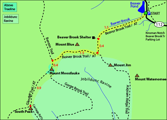
MOUNT MOOSILAUKE
UP including walkabout at Beaver Brook Shelter and
lots of Pictures.
TRIP HOME BED AT 9h30 PM |
||||||
|
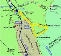
SUNDAY,
October 12th
2014
4h30 AM car trip 3 hours 30 mins + (including 4 mins
at customs)
MOUNT JACKSON and Webster loop
Aches & Pains : really feel my last two days of training.. quite glad that it was a moderate hike today. just perfect.
TRIP HOME BED AT 10h00 PM M+2 arrive later |
|
SATURDAY,
July 3rd 2015
5h200
AM car trip 3 hours (including 10 mins at customs)
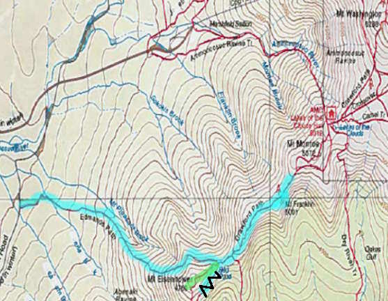
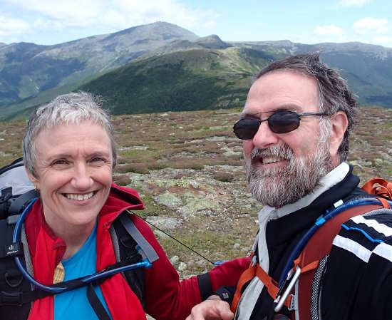
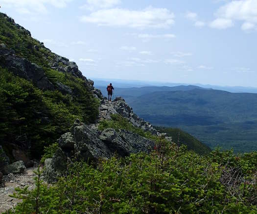
MOUNT
EISENHOWER and FRANKLIN extra TEMPERATURE 15°C and sunny, Aches & Pains : This is a test run and it's all good, but I'm very nervous about my right knee and wrist.
TRIP HOME BED AT 9 h00 PM |
|
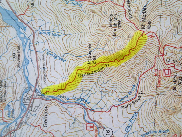
MONDAY,
July 13th 2015
5h200 AM
car trip 3 hours (including 5 mins at customs)
Mount
Moriah, NEW HAMPSHIRE TEMPERATURE Warm. Heard thunder for about 45 mins, but only had a few drops of rain near the end of the hike. Just in time before the showers. Aches & Pains : Th
BED AT 9 h00 PM at :Northern Peaks Motor Inn, Gorham. Room 18; with microwave oven and small fridge. |
|
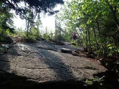
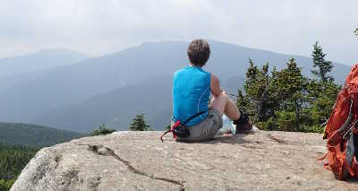
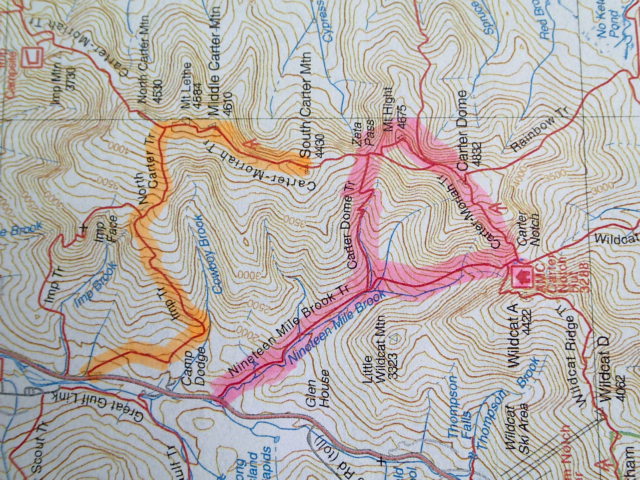
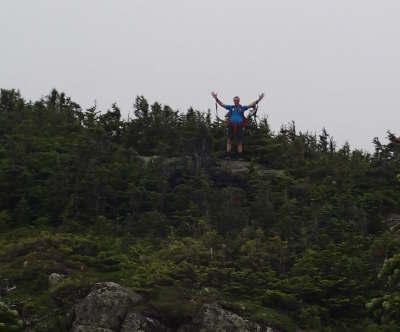
TUESDAY, July 14th 2015
Mount
Middle Carter and Mount South Carter, NEW HAMPSHIRE TEMPERATURE Quite a few times during the day we thought it would rain, so we put the pac covers on but it was very warm.
BED AT 8h00 PM at : Northern Peaks Motor Inn, Gorham. Room 18; with microwave oven and small fridge. |
|
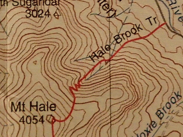
WEDNESDAY, July 15th 2015
Mount
Hale, NEW HAMPSHIRE TEMPERATURE Rain starting at 3 AM until about 10 AM. so we changed our plans to do a hike mostly in the afternoon. Aches & Pains : Th
BED AT 9h30 PM at : Northern Peaks Motor Inn, Gorham. Room 18; with microwave oven and small fridge. |
|
THURSDAY,
July 16th 2015 TEMPERATURE Beautiful, Sunny and cool! Aches & Pains : Th
TRIP HOME BED AT 9 h00 PM |
|
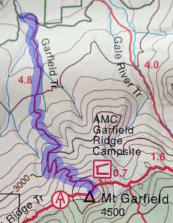
TUESDAY,
July 21st 2015
4h20 AM
car trip 3,5 hours (including 5 mins customs )
Mount
Garfield, NEW HAMPSHIRE TEMPERATURE Hot and humid but nice on top.
BED AT 9 h00 PM at :Northern Peaks Motor Inn, Gorham. Room 16; with microwave oven and small fridge. |
||||||||
|
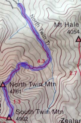
WEDNESDAY, July 22nd 2015
North Twin,
South Twin, NEW HAMPSHIRE = 24!! TEMPERATURE : Perfect! (says Gaby :) Aches & Pains : Th
BED AT 9h30 PM at : Northern Peaks Motor Inn, Gorham. Room 16; with microwave oven and small fridge. |
|
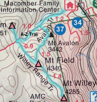
THURSDAY, July 23rd 2015
Mounts
Tom, Field and Willey, NEW HAMPSHIRE TEMPERATURE More clouds than we expected but cleared around noon Aches & Pains : Th
TRIP HOME BED AT 10h30 PM |
|
MONDAY, August 10th 2015 TRAVEL
TO
4h20 AM
car trip 3,5 hours (including 5 mins customs )
North Conway, NH today : First Light : 5:11 / Sunrise 5:43 / Sunset 7:56 / Last Light 8:28
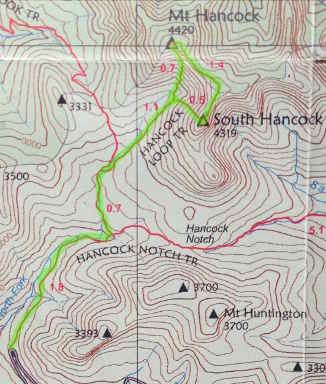
Mount
Hancock & South Hancock, NEW HAMPSHIRE TEMPERATURE Aches & Pains : Th
planned BED AT 9 h00 PM at : White Mountain Hostel, 36 Washington Street, Conway, NH |
|
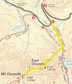
WEDNESDAY, August 12th 2015
East
Osceola, Mount
Osceola, NEW HAMPSHIRE TEMPERATURE Aches & Pains : Th
planned BED AT 9 h00 PM at :White Mountain Hostel, 36 Washington Street, Conway, NH |
|
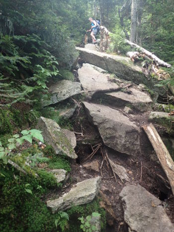
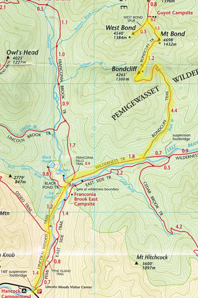
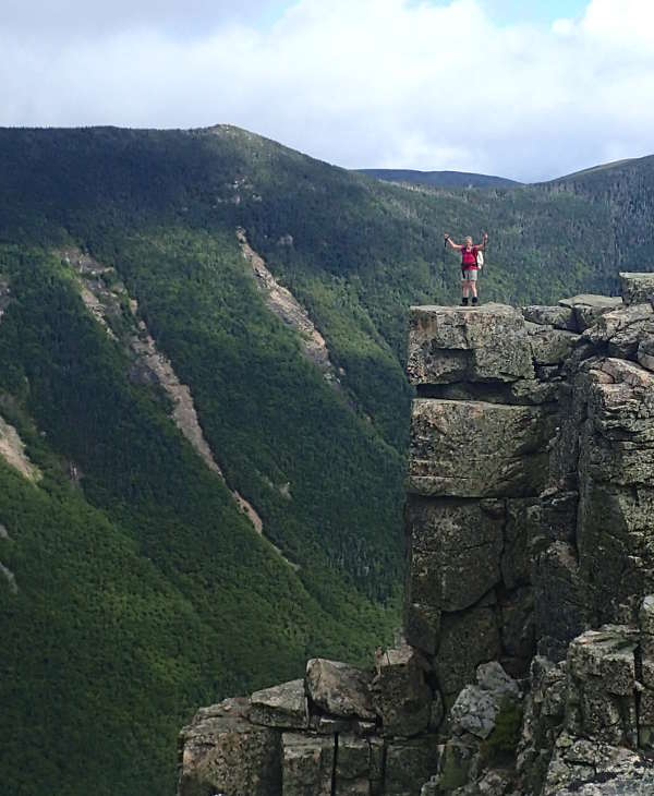
THURSDAY, August 13th 2015:
Mounts
Bondcliff, Bond & West Bond , NEW HAMPSHIRE TEMPERATURE Aches & Pains : Th
planned BED AT 9 h00 PM at :White Mountain Hostel, 36 Washington Street, Conway, NH |
||||||||||
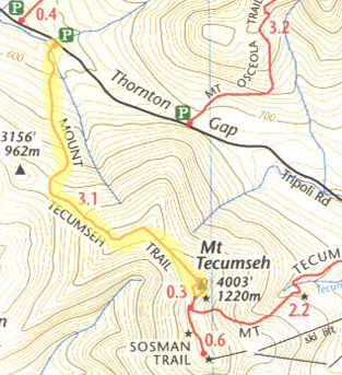
|
FRIDAY, August 14th 2015
Mount
Tecumseh, NEW HAMPSHIRE TEMPERATURE 21° C at start, and luckily it goes down at least a litte.. t0 18°C Aches & Pains : Th
Trip Home |
|
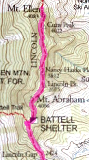
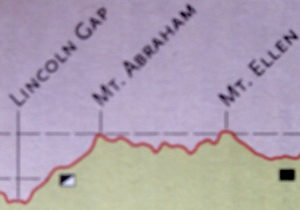
SATURDAY, September 5th 2015
Mount
Abraham & Mount Ellen, Vermont
my
order # 3 + 4 / 21
// # 84 + 85 / 111 TEMPERATURE 15°C excellent.
BED AT 9h30 PM at : GIFFORD WOODS STATE PARK Lean-to : Birch |
|||||||
|
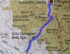
SUNDAY, September 6th 2015
Mount
Killington, Vermont 5/5 and North East 86/115
my
order # 5 / 21
// # 86 / 111 TEMPERATURE 12-21° C. beautiful sunny, a little warm day. Aches & Pains : Th
CAR TRIP HOME BED AT 9h30 PM |
|
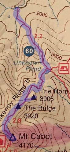
FRIDAY,
May 20th 2016
Car trip to the Northern-most 4000 footer in the Whites : See a deer in the morning and a moose coming hone.
Mount Cabot, White Mountains,
From
Mill Brook Road Tear a little the skin on my left knee, climbing to the top bolders of the Horn. Gaby says that I don't seem quite as sure of myself as usually, and it's true.. my legs are almost shaking at times from being tired. But the 360° view on a sunny day with snow still on Mount Washington, and a good view of The Buldge and Mount Cabot is worth it. It's the best place to have lunch. Aches & Pains : Just weak and tired.. I think my training this year isn't as effective as it was with A.M. Gabriel takes one of my hydration packs, and I feel better but still it's difficult.
|
||||||
|
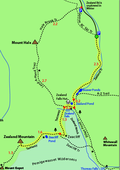
SATURDAY,
July
2nd 2016
Mount Zealand, White Mountains, From Zealand Road parking. 3$
BED AT 10h30 PM |
||||||
|
SATURDAY,
July 9th 2016
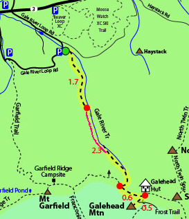
Mount Galehead, White Mountains,
BED AT 10h30 PM |
||||||||
|
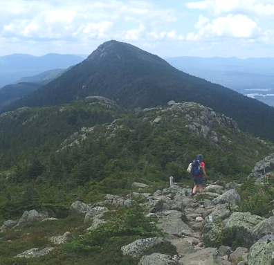
TUESDAY, July
19th 2016
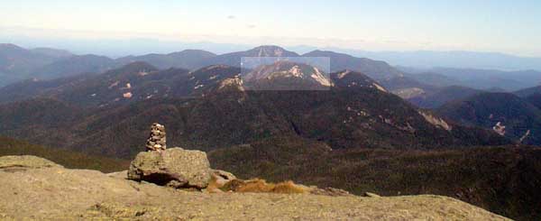
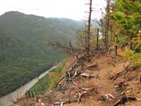
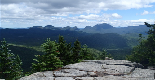
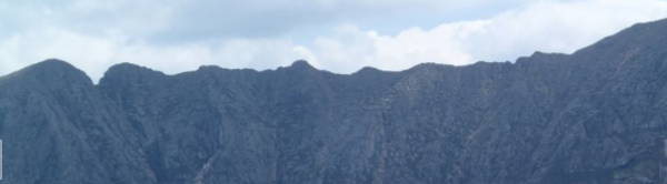
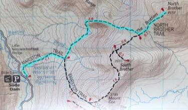
North Brother
Banner Picture is the
Knife Edge, viewed from North Brother.
my
order # 6 / 21
// # 90 / 111 talked with Audrey (park ranger) / un couple québécois on the trail, at RB campground with Bob who's wife was doing a 4 day BP trip. and Jim & Jen who were with hamocks on camp #10.
BED AT 8h30 PM Camping Baxter State Park / Roaring Brook Walk-In Lean-to #11 |
|
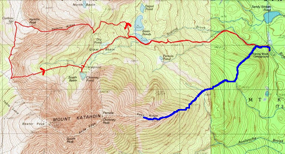
WEDNESDAY, July
20th 2016
on Katahdin : towards Baxter Peak
with Gabriel and
for about 2 hours with Jim Shields (JPS Mountain
Adventures) & Jen. Talked with : Jim & Jen who started out 40 mins before us but waited because of the wind, and came down. / girl & John, her "going on 80" years old grandfather / 3 guys who also came down because of the wind.
planned BED AT 10h30 PM Camping Baxter State Park / Roaring Brook Walk-In Lean-to #11 |
||||||
|
THURSDAY, July
21th 2016
Talked
with Ranger Rob who said yesterday's winds on KE were
in the "Upper 40s" miles per hour.
Kathadin
Hamlin Peak
my
order # 7 / 21
// # 91 / 111 NICE SURPRISE : UN-NAMED SPRING NEAR TOP OF HAMLIN and CARIBOO SPRING on the way to Saddle trail. Talked with a father & son from Montreal ( originally from Slovenia) . Gaby had met them yesterday. / I talk too much.
BED AT 10h30 PM Camping Baxter State Park / Roaring Brook Lean-to #8 |
||||||
|
TUESDAY, July
26th 2016 Day 1 CAR TRIP to the WHITE MOUNTAINS, NH. Gabriel's car : TROUBLE!
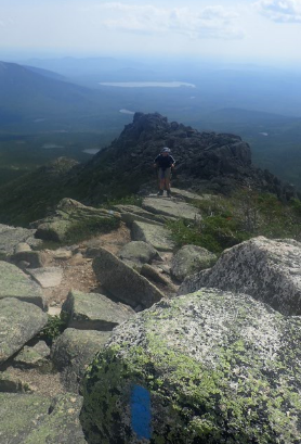
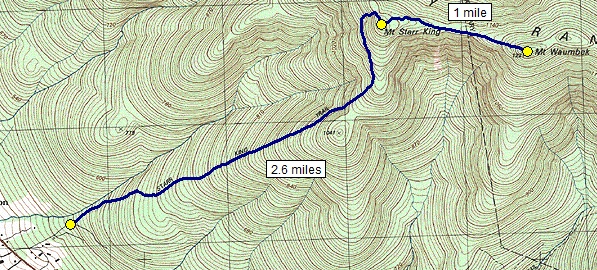
Mount Waumbek
In the evening at the Hostel talk alot with Bob & Leon, not regular hikers but are going to do Mount Washington tomorrow, Billy from Maine, who hikes alot, Xenia from Moscow and Doug and Mark BED AT 10h30 PM at : White Mountain Hostel, 36 Washington Street, Conway, NH room #6 new bed but not much more. |
||||
|
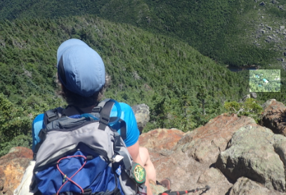
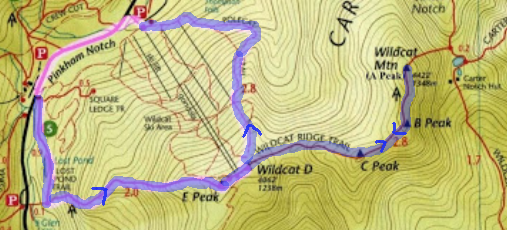
WEDNESDAY, July
27th 2016 Day 2
Wildcat, D& E, and Wildcat A
BED AT 11h30 PM at : White Mountain Hostel, 36 Washington Street, Conway, NH |
||||||||
|
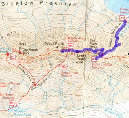
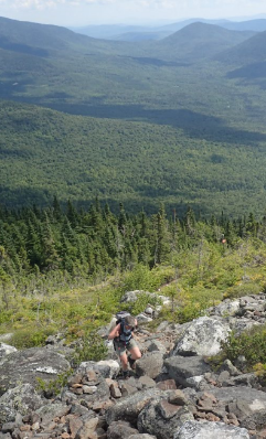
TUESDAY, August 2nd 2016 Day 1 4h30 AM : CAR TRIP to Maine
Mount
Bigelow
Avery Peak & West
Bigelow
my
order # 8 + 9 / 21
// # 95 + 96 / 111
BED AT 9h30 PM
|
|
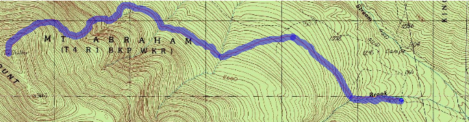
WEDNESDAY, August 3rd 2016 Day 1 My car (Hyundai Accent 2013) : last 1/2 mile very difficult because my car is low, and the road is bad!!
Mount
Abraham
Maine
my
order # 10 / 21
// # 97 / 111
CAR TRIP HOME
first half mile VERY BAD /
Thanks Gabriel for your patience and care in driving. |
|||||
|
FRIDAY,
September 2nd 2016
CAR TRIP to
Lincoln Wood Center
BACKPACK IN
2,9 mi, 1h10min
BED AT 8h00 PM Camping Franconia Brook East Tentsite #16 |
|
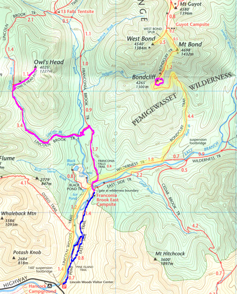
SATURDAY,
September 3rd 2016
Owl's Head Mountain, NE 98/115
BED AT 8h00 PM Camping Franconia Brook East Tentsite #16 ALOT of hikers at campground arriving at all hours of the evening. SUNDAY, September 4th 2016 DO Bondcliff (again) In the longrun I want do have a separate date for each of the 48 White Mountain High Peaks, so since we did the 3 Bonds at once, we did just Bondcliff this time and plan to go back and do one of the other via Guyot.. some day.. but today doesn't count for the 48 since we've already done all three Bonds. |
|
MONDAY,
September 5th 2016
BACKPACK OUT
CAR TRIP home BED AT 10h30 PM AT HOME |
|
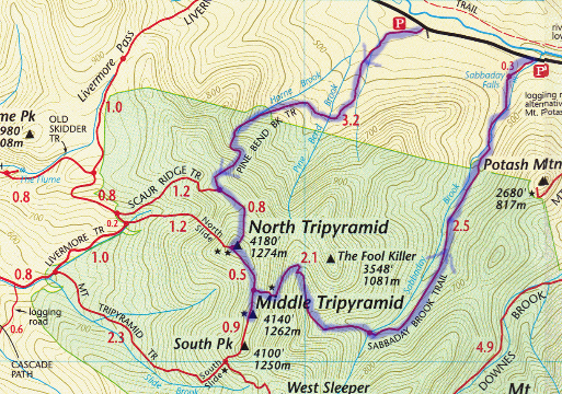
FRIDAY, October 7th 2016
CAR TRIP to Pine
Bend Brook Parking.
North and Middle Tripyramids, NE99 and 100 / 115
CAR TRIP home |
||||||||
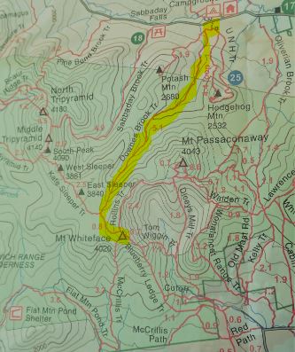
|
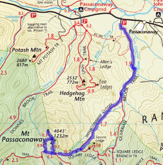
SATURDAY,
October 15th 2016
CAR TRIP to the
Whites
Mount Passaconaway NE 101 / 115
CAR TRIP home |
||||||||
12 day TREK in the Dolmites, Italy + 2 hikes — Summer 2017
|
SATURDAY,
September
2nd 2017
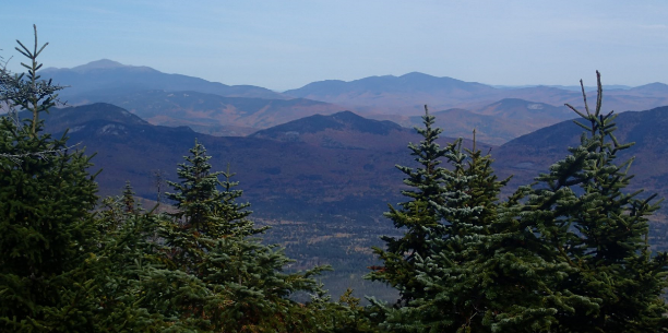
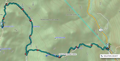
ISOLATION, White Mountains, NH
:NE111
: 102/115 Back-pack 19lbs : so nice that it was less than the 33 lbs I carried around in the Dolomites!
BED AT 10h30 PM at : White Mountain Hostel, 36 Washington Street, Conway, NH |
||||||||
|
SATURDAY,
June
30th
2018
20mins drive to Trail Head.
WHITEFACE, NH.
WHITE MOUNTAINS , NE103 / 115
CAR TRIP home |
|
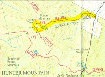
WEDNESDAY,
July
18th
2018
20mins drive to Trail Head.
HUNTER MOUNTAIN,
CATSKILLS, NY , NE104 / 115
my order # 11 / 21
// # 104 / 111
BED AT 8h00 PM Woodland Valley Campground, NY |
|||||
|
THURSDAY,
July
19th
2018
40 mins drive to Trail Head.
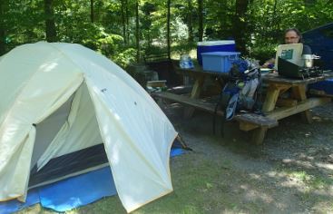
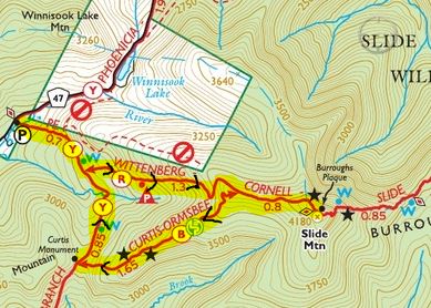
SLIDE MOUNTAIN, CATSKILLS, NY, NE105 / 115
my order # 12 / 21
// # 105 / 111
BED AT 10h00 PM Woodland Valley Campground, NY |
|
WEDNESDAY, July
24th
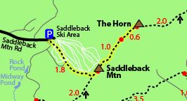
2018 60 mins drive to Trail Head. SADDLEBACK,
MAINE & SADDLEBACK HORN MOUNTAIN,
BED AT 8h00 PM Maine State Park Campground.. .. site #131. |
|||||
|
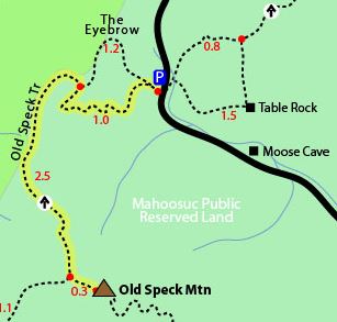
THURSDAY,
July
25th
2018
1h07 mins drive to Trail Head. OLD SPECK
MOUNTAIN,
MAINE
my
order # 15 / 21
// # 108 / 111
BED AT 7h00 PM Maine State Park Campground.... site #131. |
||||||||
| SUNDAY,
August
5th
2018 30 mins drive to Trail Head. CARRIGAIN MOUNTAIN
White
Mountains,
/ NE109/115
BED AT 10h45 PM White Mountains Hostel, Conway / Bunks #11 (2 singles and 4 bunks , sink in room, showers and washroom adjacent) / Interesting to meet Danièle and Rebecca and alot of other hikers. With all the "congrats" we get it really feels like a celebration . |
|||||||||||||||
|
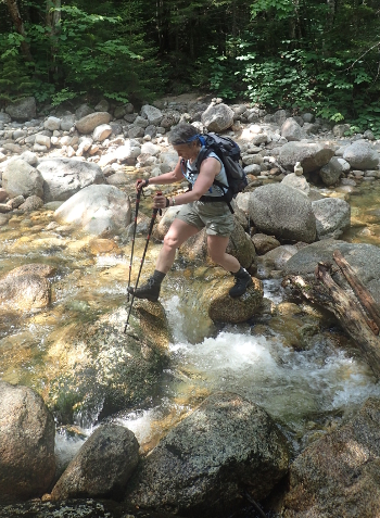
SATURDAY, July 27th 2019
SPAULDING & SUGARLOAF
Get up at 5am
TOTAL TIME 10h50 mins!
(very slow) I don't feel well. Is it the
Effexor? also I see double and Gaby has cramps TEMPERATURE Too hot
BED AT 7 h30 PM
at :
Happy Horseshoes Campground #39aa Late reservation,
didn't find a Tents campground. |
|
SUNDAY, July 28th 2019
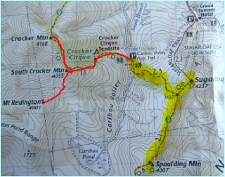
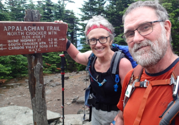
SOUTH CROCKER, REDDINGTON,
CROCKER TOTAL TIME 10h15 mins! (very slow) I'm still seeing double and take off my hr monitor after a couple of hours because it's just giving me crazy readouts like the 221 yesterday. I take the strap off because it's hot and uncomfortable. TEMPERATURE Too hot again, but some very light showers just enough to cool us down a little. Do hear thunder at times.
BED AT 8 h00 PM at : Happy Horseshoes Campground #39aaThere was a huge storm today at the campground and our tent is quite wet so we are invited by the owners to sleep in the # Hot Hut! Thanks ! Keeping it real Still seeing double when I look more than 10' away and it continues all day and night. Note I'm ok the next morning. |
|
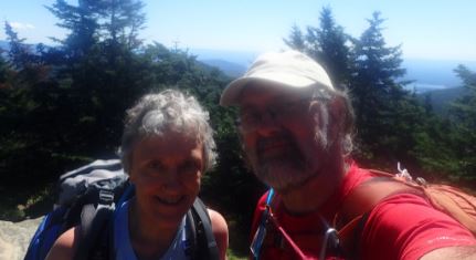
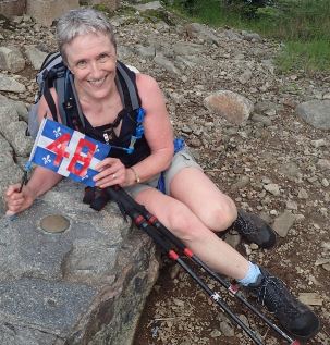
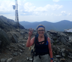
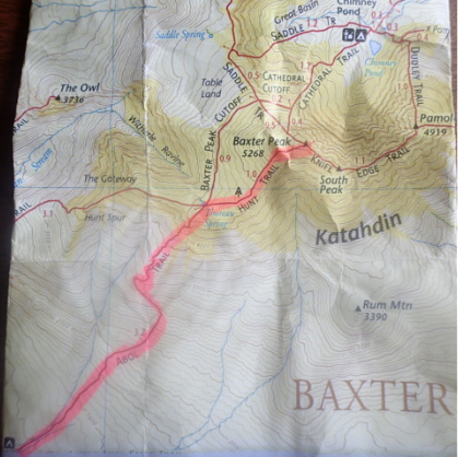
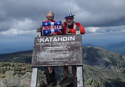
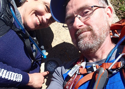
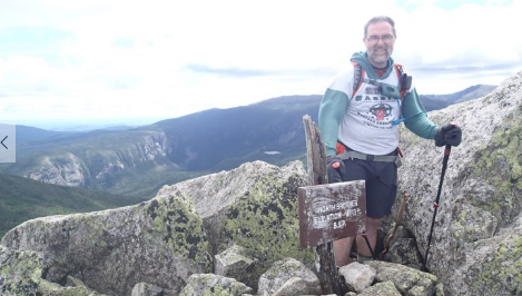
TUESDAY, August 13th 2019
KATAHDIN, BAXTER PEAK
NE111 ! my list # 10/10 This finishes the 10 highest of the North East that I said I wanted to do when Gaby told me he wanted to do the ADK46.
Get up at 5am at
Nesowadnehunk Field
TOTAL TIME 11h30 mins!
(very slow, Gabriel is very patient
waiting for me and knows that I'm having trouble this year, maybe because of
the Effexor.) 6h30 mins UP / 30 mins Lunch & photos / 4h30 mins
DOWN TEMPERATURE 10°C - 18°C quite a bit of wind at times (just right)
BED AT 7 h30 PM
at : Nesowadnehunk Field Lean-to #6 |
| On october 10th I send my 6 pics and comments to the organizers of the Awards night. |
|
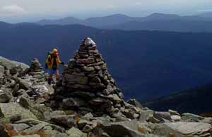
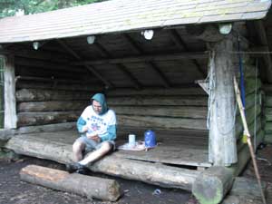
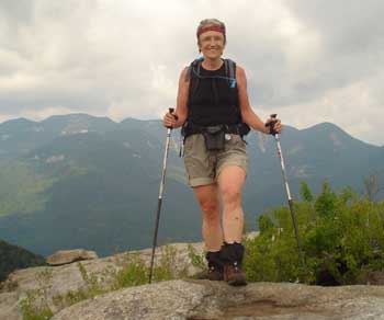
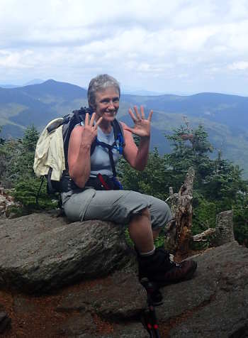
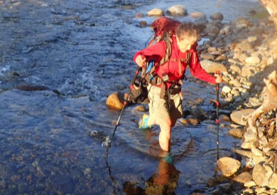
Here are my photos for the Awards night. Mary-Louise Szoka #970 Thanks for all you’re doing to make finishing special. After 14 years of doing these peaks.. I’m really proud. I was sort of an athlete when I was in my late teens and early 20s.. (fencing) but in 1982 when I was 28, I paralized from the waist down due to a C-Section Epidural and some bad luck. It took 10 days for the doctors to say that “maybe one day I’ll walk”. After 5 years I still had trouble going up a set of stairs (It didn’t show but I felt it) I continued doing my best.. some mountains in Québec in the ‘90s.. My life was cut in half .. before and after. Then just down from Mt. Washington in 2006.. I realized there was Before and there was After, and there was NOW. My life would have surely been different if all this hadn’t happened, I would not be the same person, but I like who I am and still now there isn’t one day that I’m on a trail that I don’t tell myself how lucky I was to have the courage to get up and climb
|


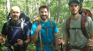 Three
guys doing the Long Trail South to north.
They plan on doing it in 3 weeks and seemed
quite curious about their first 4000-footer..
Killington, just ahead. I was sorry to say
that the view from the top didn't impress me
that much, but alot of people found it
beautiful. I said it depends on what else
you've seen in your life.
Three
guys doing the Long Trail South to north.
They plan on doing it in 3 weeks and seemed
quite curious about their first 4000-footer..
Killington, just ahead. I was sorry to say
that the view from the top didn't impress me
that much, but alot of people found it
beautiful. I said it depends on what else
you've seen in your life.


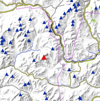
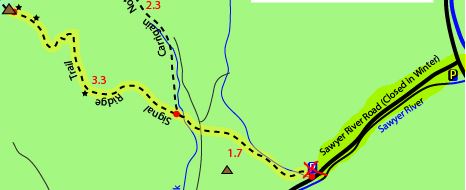
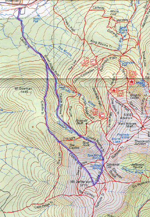
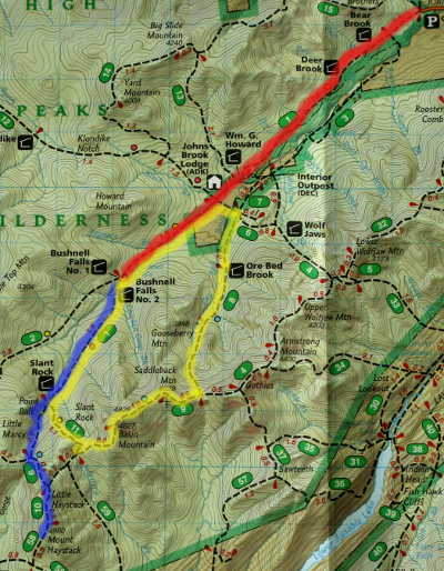
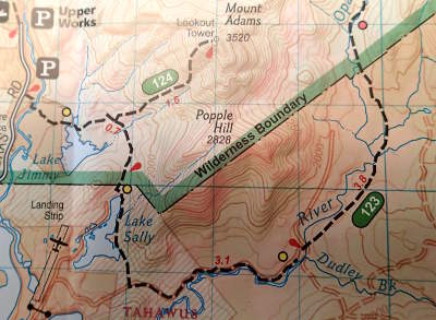
 MAP
: We chose a short but steep route.. with blue (B) trail
markers all the way up and then
MAP
: We chose a short but steep route.. with blue (B) trail
markers all the way up and then